Lemosho Route – Kilimanjaro Climb
The Lemosho Route is one of the most scenic and less crowded routes. It is usually trekked over 7–9 days for…
Route detailHome Kilimanjaro guide
Geff Travel · Mount Kilimanjaro
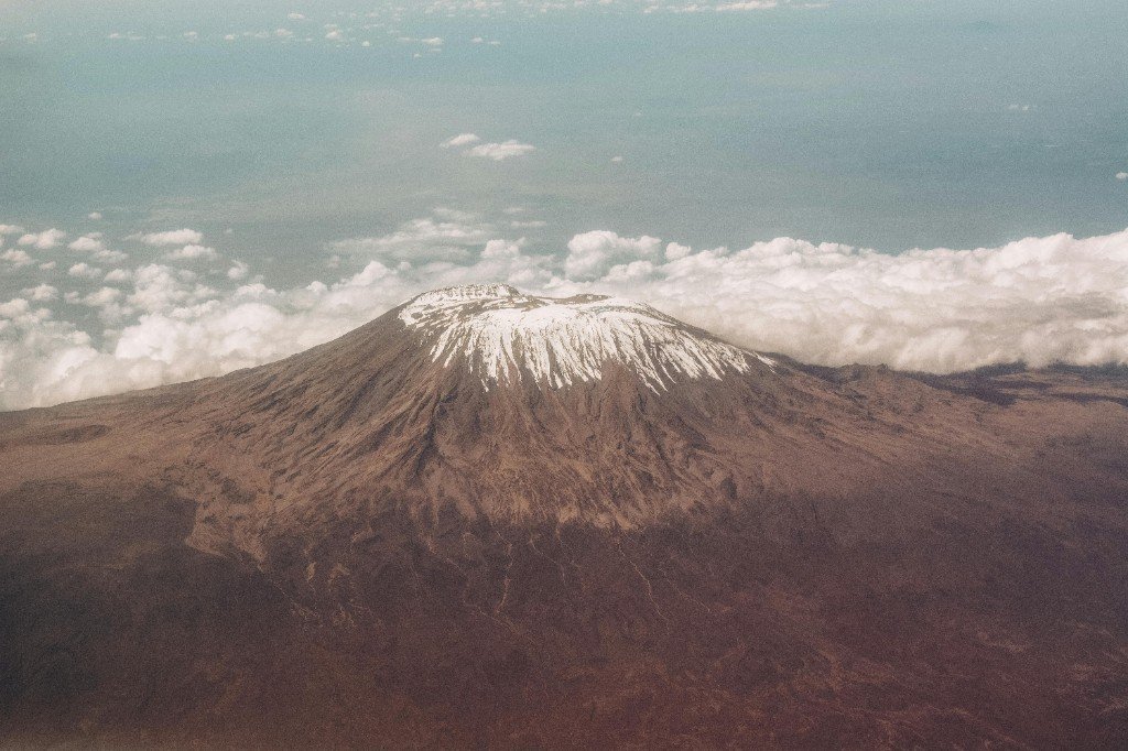
Africa’s highest peak (5,895 m / 19,341 ft) is a high-altitude trek — not a ropes-and-ice climb. This Geff Travel guide explains what to expect, how to prepare, how pricing works, and how to pick a route that matches your dates and fitness.
Every summit path we quote — open a card for inclusions, indicative pricing in TSh, and the full day-by-day schedule.
The Lemosho Route is one of the most scenic and less crowded routes. It is usually trekked over 7–9 days for…
Route detail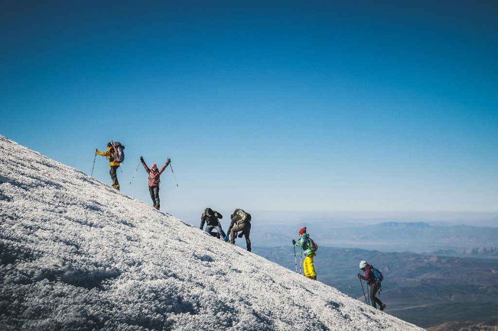
Climb Africa’s highest mountain through the scenic Machame Route. This route offers breathtaking landscapes,…
Route detail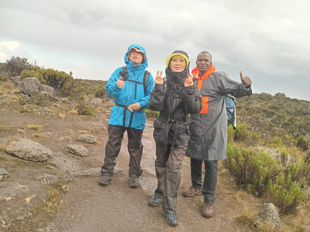
The Marangu Route is known as the “Coca-Cola Route” and is the only route with comfortable mountain huts inst…
Route detail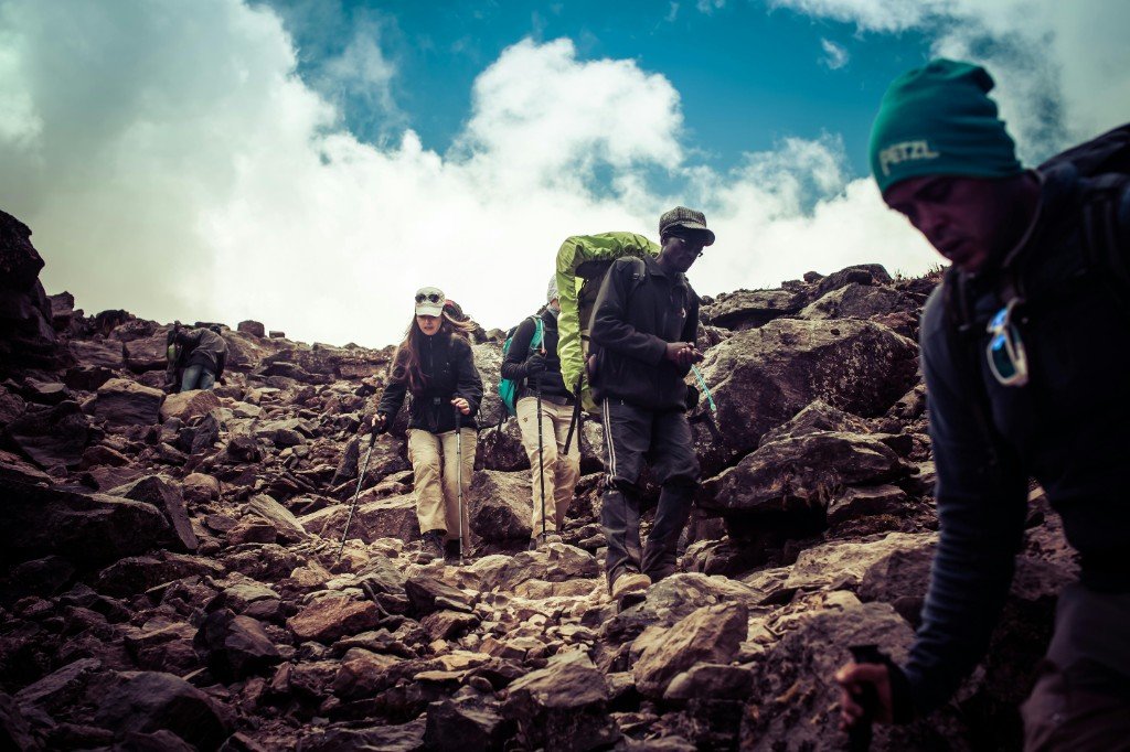
The Rongai Route approaches the mountain from the northern side near the Kenyan border and is one of the quie…
Route detail
Umbwe is the steepest and most challenging route to the summit. It is recommended for experienced climbers.
Route detail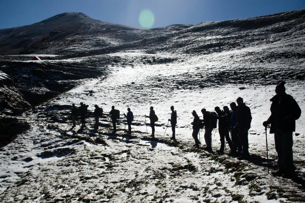
The Northern Circuit is the longest route and offers the best acclimatization with the highest summit success…
Route detail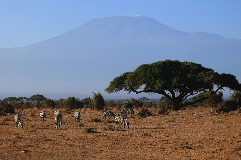
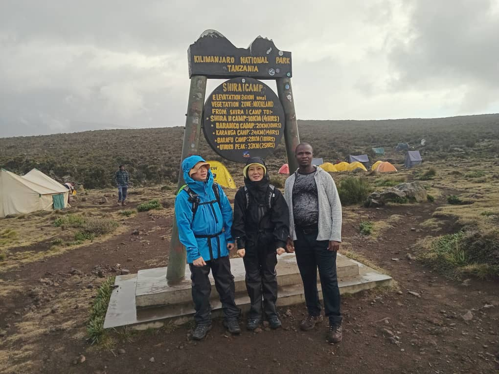
The Shira Route begins on the western side of Kilimanjaro and crosses the stunning Shira Plateau.
Route detailMost climbers fly into Kilimanjaro International Airport (JRO), then transfer to Moshi or Arusha for briefings, gear checks, and the start of the road approach to their trailhead. Success is less about climbing skill and more about steady pacing, hydration, sleep, and an itinerary with enough days for acclimatization.
Geff Travel plans ethical mountain crews, quality equipment, and daily health monitoring so you can focus on the trail while guides make conservative decisions in changing weather and altitude.
A typical private or small-group expedition follows the same backbone: acclimatize gradually, sleep lower than your high point when the route allows, and summit in the dark to reach the crater rim at sunrise.
Route selection, dates, medical questionnaire, and travel insurance that explicitly covers trekking up to 6,000 m. We confirm airport transfers, pre-climb hotel nights, and any add-ons (safari, Zanzibar).
You move camp to camp with guides, cooks, and porters. Days mix steady hiking, rest at camp, and briefings. Summit night is long and cold — patience and following your guide’s pace are essential.
Most itineraries descend quickly to thicker air and warmer zones. A celebration meal in town caps the trip before onward travel or safari extensions.
You cross distinct ecological bands in a few days — from humid forest to near-Arctic wind and ice near the rim.
Weather changes fast. Expect sun, wind, and sometimes rain in the same week. Summit night often feels like the hardest mental challenge — not because the moves are technical, but because of cold, fatigue, and thin air.
Park and conservation fees make up a large share of every invoice. Ethical wages, food, tents, safety kit, and guide ratios are the rest — if a price looks too low, corners are usually cut somewhere risky.
As a rule of thumb, well-run 7–9 day itineraries (including Lemosho and similar western approaches) often fall in a mid-to-upper range once permits, crew, meals, and mountain logistics are included. Shorter 5–6 day trips can cost less upfront but carry a higher acclimatization risk for many people.
Your written quote from Geff Travel spells out inclusions (transfers where agreed, park fees, mountain food, tents or huts, guides, porters within KPAP-aligned practices) and anything you book separately (flights, tips, personal gear, travel insurance).
Send dates and group size — we’ll recommend a route length that balances budget and safety.
You don’t need to be an athlete — you need durable legs, lungs, and the habit of long, slow days on your feet.
Acute mountain sickness (AMS) is the main risk. Serious HACE and HAPE are less common but emergencies when they occur.
Prevention: choose a longer route where possible, hydrate, eat even when appetite drops, and walk slowly (“pole pole”). Honest daily check-ins with your guide matter — hiding symptoms helps nobody.
Warning signs: worsening headache, nausea, loss of coordination, confusion, or breathlessness at rest. The right response is often descent — oxygen and emergency plans exist, but going down remains the definitive treatment.
Geff Travel equips teams with appropriate medical kits and communication options; your job is to communicate early and follow professional advice even if it means turning back — the mountain will wait.
Layering is the system: wicking base, insulating mid, windproof shell, and a serious down or synthetic parka for summit night.
We send a detailed kit list after booking. Many items can be rented locally — ask during planning so you travel light.
This schematic shows how major trails approach the summit from different sides of the cone. It is not a navigation map — on the mountain you always follow your guide and park regulations.

“Best” depends on your calendar, budget, appetite for crowds, and how many days you can spare for acclimatization. Public guidance from leading Tanzanian operators (for example Altezza Travel, Zara Tanzania Adventures, and dedicated Kilimanjaro educators such as Climb Kilimanjaro) consistently stresses longer western or circuit routes for first-time altitude trekkers — we apply the same conservative logic to your private Geff Travel plan.
Starts remote on the west; crosses Shira Plateau and usually joins the southern circuit. Scenic, gradual, and a strong choice for first-timers who can commit to a longer itinerary.
Pros: Gradual gain, high success potential on 7–9d. Cons: Slightly higher cost and drive to trailhead.
Across the industry, Lemosho is promoted as the western “smart default” when acclimatization matters more than the shortest possible trip — the same route family highlighted on major Tanzanian booking sites for higher summit comfort.
Varied scenery from rainforest to the southern traverse; busy in peak season but well proven. Seven-day Machame is strongly preferable to six for AMS risk.
Pros: Classic views, good lodge-to-trail logistics from Moshi. Cons: Can feel crowded on summit night merge points.
Machame appears on almost every large operator’s “top routes” list because Barranco, Karanga, and Barafu give recognizable stages — but crowds at choke points mean patience and guide coordination matter as much as fitness.
Only route with dorm-style huts. Same path up and down unless you add a variant. Shorter schedules can feel rushed — discuss honestly with Geff Travel if you’re unsure about your altitude response.
Pros: No camping in huts, predictable bed. Cons: Less flexible than tents; ascent/descent overlap.
Hut-based logistics appeal to travellers who want simpler shelter stories — but ethical operators still explain that fewer vertical-relief days can raise AMS probability; industry listings price shorter Marangu windows lower for a reason.
Drier feel on the Kenyan side approach; often quieter. Good option in rainy months when northern sectors catch less precipitation.
Pros: Different perspective, sometimes less rain. Cons: Longer drive to start; still demands respect for altitude.
Northern-approach marketing (including Zara’s group departures and Altezza’s route pages) often cites weather patterns — your Geff Travel planner still verifies gates, roads, and ranger notices before locking dates.
Fast vertical gain early — best for trekkers with strong hiking backgrounds and extra acclimatization days built in. Not our default recommendation for most first-time altitude trekkers.
Pros: Dramatic, less initial traffic. Cons: Demanding profile if compressed.
Serious outfitters list Umbwe as specialist terrain — the adventure brands that promote adrenaline still build rest or merger days into the plan because abrupt gain without recovery invites evacuations.
Traverses around the quieter northern flanks before a summit bid. Excellent acclimatization timeline; ideal if you want solitude and have the holiday time.
Pros: Superb altitude curve, panoramic variety. Cons: Highest cost and time commitment.
Premium listings position the Northern Circuit as maximum acclimatization and minimum crowd overlap — aligned with how international operators justify higher quotes (more mountain days, more crew shifts, more food freight).
Begins nearer the plateau; can skip lower forest. Great for those already acclimatized — others may feel the first days punchy. Often combined logically with Lemosho-style planning.
Pros: Big sky plateau quickly. Cons: Faster jump in altitude at the start for some groups.
High-start variants appear across operator catalogs for repeat visitors or Meru pre-acclimatized teams — we only recommend Shira-style jumps when your history supports them.
Where each day starts and ends, approximate elevation, distance in kilometres, and typical hiking time — so you can picture the rhythm before you book. Figures follow published schedules used by established Tanzanian operators; your Geff Travel team may adjust camps and times for weather, pace, and park logistics.
For seasonal planning and route character, cross-check Altezza Travel, Zara Tanzania Adventures, Climb Kilimanjaro, Monkey Adventure, and Nafika Tours — then let Geff Travel tailor your private dates.
One of the most beautiful, less crowded western approaches. A gradual climb supports acclimatization and summit success. Below is a classic 7-day Lemosho schedule.
Most trips add arrival day(s) in Moshi: airport transfer, briefing, gear check, and welcome dinner before the trek starts.
Rainforest trail with birds and monkeys; first night in camp.
Moorland and wide views; first high camp on the Shira massif.
Climb high, sleep low for acclimatization; dramatic Barranco setting below the wall.
Barranco Wall scramble then gentler hiking toward the southern circuit.
Short day to the high camp; rest before the midnight summit push.
Summit via Stella Point; long descent to thicker air and forest edge.
Rainforest descent; certificates at the gate, then transfer to Moshi.
The popular “Whiskey” route from the south: forest, Shira, Lava Tower, Barranco, and Mweka descent. Seven days give a safer acclimatization curve than six.
Humid rainforest to heath; steady gain on a well-trodden trail.
Shorter day with big views toward Kibo and the plateau.
Classic climb-high, sleep-low day before the Barranco Wall.
Barranco Wall in the morning, then easier going to Karanga.
Final push to high camp; hydrate and sleep before summit night.
Midnight start; crater rim and summit, then long descent.
Forest trail to the gate; celebration and drive to town.
The only route with dormitory huts; same trail up and down. Six days add a little more rest at Horombo than a five-day schedule.
Forest path to the first hut cluster.
Heath and moorland with wide views.
Alpine desert crossing toward the summit massif.
Steep summit night on scree; descent back to Horombo for recovery.
Long descent through moorland.
Final forest walk to sign out and certificates.
Quieter northern start near the Kenyan border; often drier underfoot. Descent typically uses the Marangu route to maximize safety and variety.
Pine forest and open slopes on the north side.
Gain height toward Mawenzi views.
Short day below dramatic Mawenzi spires.
Cross the “saddle” toward the summit cone.
Summit bid, then long descent to Horombo on the Marangu side.
Continue down through moorland.
Exit through the forest to the vehicle road.
Shortest and steepest “direct” line to the southern circuit — demanding early vertical gain. Best for strong hikers with a measured pace and guide-led acclimatization.
Steep forest climb to the first camp.
Joins the Machame/Lemosho corridor at Barranco.
Barranco Wall, then Karanga.
Rest and prepare for summit night.
Summit and descent to forest-line camp.
Final descent and certificates.
Circles Kibo on quiet northern trails before the summit push — excellent time at altitude. Camp names can vary slightly; distances are approximate.
Same western forest start as Lemosho.
Emerging onto the plateau.
Wide skies and acclimatization on Shira.
Branch north toward the quieter circuit (via Lava Tower zone).
Traverse the northern slopes with panoramic views.
Rounding toward the northeast side of the cone.
High camp on the north side before the summit bid.
Summit from the north; descent to Mweka forest.
Last rainforest miles to the gate.
Begins near Shira Gate on the plateau — less forest walking but a faster jump in altitude on day one unless you walk in from Londorossi. Soon joins the same southern-circuit camps as Machame/Lemosho.
Short day if driven to the gate; longer if trekking from the forest.
Cross the plateau toward Kibo views.
Standard acclimatization day shared with Machame/Lemosho trekkers.
Barranco Wall and Karanga valley.
Final camp before summit night.
Summit and descent.
Forest trail to the finish.
Yes — many first-time trekkers summit with the right route length and a cautious pace. Prior multi-day hiking helps, but technical climbing skills are not required.
Many travelers aim for drier windows roughly late December–February and June–October. Rainier months are still possible with the right route (for example northern approaches) and mindset.
Yes — confirm coverage for trekking to 6,000 m, medical evacuation (helicopter where available and weather permitting), and trip interruption. Read the fine print before you pay the premium.
Message Geff Travel with your month, route interest, and group size. We’ll confirm availability, crew ratios, and a transparent itinerary. Contact form →
Local Moshi operator · Ethical crew standards · Clear inclusions